The following maps were generated from the ARRL's online contest database of results for the 2004 ARRL June VHF QSO Party. Callsigns are matched up to ZIP codes using the FCC database, which are then matched up to latitude and longitude (which means that two stations in the same ZIP code will be given the exact same latitude and longitude values.) The mapping software I used only does maps the United States of America, so these maps are limited to only U.S. contestants. Furthermore, these maps only represent U.S. contestants that submitted a log to the ARRL after the contest and who were not operating in the Rover category. (Entrants in the single operator, portable categry are mapped using their callbook ZIP codes, even though they might have operated from another location.) There are certainly many more stations across the country who operate the contest, but do not send in their logs.
The objective of these maps is not to be 100% accurate about the locations, but to give contesters an aggregate visual representation of activity in the contest.
|
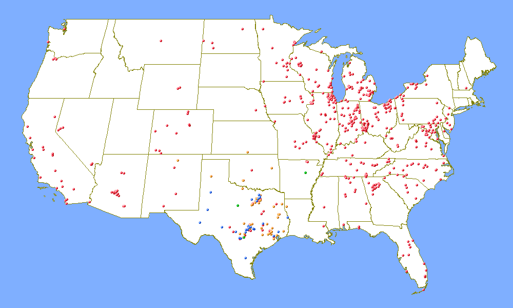
Locations of USA stations worked by K5TR, multi-limited in EM00uf,
in the 2004 ARRL June VHF QSO Party, color-coded by highest frequency
band worked. Red is 50 MHz, orange is 144 MHz, green is 222 MHz, and
blue is 432 MHz. Rover stations are not included in this map.
|
|
Last Updated 26 June 2020 wm5r@wm5r.org |